You are using an out of date browser. It may not display this or other websites correctly.
You should upgrade or use an alternative browser.
You should upgrade or use an alternative browser.
Lake maps
- Thread starter Winkels
- Start date
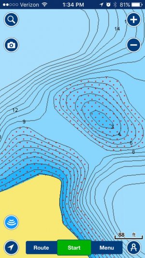
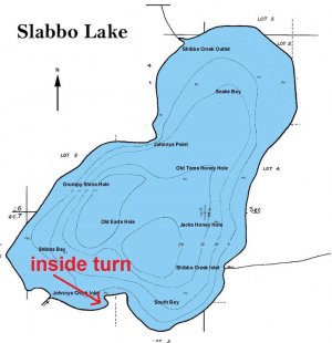
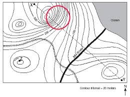
Anyone have any good information on how to identify terms such as bottlenecks, inside turns, steep breaks, etc on lake maps?
How do you mean?
- Joined
- Apr 24, 2015
- Posts
- 10,980
- Likes
- 708
- Points
- 458
Anyone have any good information on how to identify terms such as bottlenecks, inside turns, steep breaks, etc on lake maps?
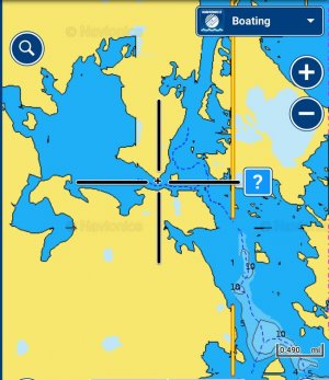
Perhaps in a legend with numerical indicators at the proper coordinates? A pop-up box when a cursor covers said numerical designator should work if you're referencing electronic maps.
Backwater Eddy
New member
- Joined
- Mar 2, 2017
- Posts
- 24
- Likes
- 0
- Points
- 56
I would say that, it might not be so much a bottle neck, as it would more so be a Saddle.
Backwater Eddy
New member
- Joined
- Mar 2, 2017
- Posts
- 24
- Likes
- 0
- Points
- 56
Similar threads
- Replies
- 0
- Views
- 1K
Recent Posts
-
Giant muskie
- Latest: johnr
-
Weather forecast & predictions
- Latest: johnr
-
Vanguard 257 Weatherby Magnum
- Latest: 1lessdog
-
Craftsman 5000-Watt Generator
- Latest: Zogman
-
What are you listening to these days?
- Latest: grumster
-
Sak Thursday 5*16*2024 East End
- Latest: Muleybuck
-
Sak Newtown 5/17
- Latest: 701FishSlayer
-
Applicators license
- Latest: BrokenBackJack
-
Project ideas for a 13yo
- Latest: Wall-eyes
-
Costa Rica Bill fishing
- Latest: svnmag
-
Velocitor/Stinger/Interceptor
- Latest: svnmag
-
RR Red River 5-16-24
- Latest: Captainbrad
-
Sak Sak - New Town Area 5/4
- Latest: grumster
-
Northern Lights
- Latest: Rowdie
-
RR Red River 5-8-24
- Latest: svnmag
-
Representative Dockter
- Latest: Trip McNeely
-
Portable Fish House Storage
- Latest: wslayer
-
What boat ramp open in Bismark
- Latest: Fester
-
Transporting Fish Question ??
- Latest: Rowdie
-
Minn kota I-pilot link swap
- Latest: Wall-eyes
Friends of NDA
Top Posters of the Month
-
This month: 70
-
- Posts
- 1,056
-
- Likes
- 944
-
-
This month: 51
-
- Posts
- 2,090
-
- Likes
- 859
-


