
America’s Most Important Megaproject You’ve Never Heard Of
No comments have been found at this time
Recent Posts
-
 Mandan Slasher!!!
- Latest: Lycanthrope
-
 new reel for all around use?
- Latest: wslayer
-
 EHD is back..AGAIN!
- Latest: Allen
-
Beef prices going up????
- Latest: measure-it
-
 Environmental Easements
- Latest: Duckslayer100
-
Mandan Data center pushback
- Latest: OL Deadeye
-
NFL News (Vikings)
- Latest: OL Deadeye
-
 Mini excavator
- Latest: KDM
-
 Bitcoin
- Latest: guywhofishes
-
 RR Red River 8-20-26
- Latest: Captainbrad
-
 Your dream squirrel rifle?
- Latest: Jiffy
-
 Surgeon Info/Gunshot Wounds YT
- Latest: svnmag
-
ND suppressor laws update?
- Latest: ndbwhunter
-
Depredation ELK tags for Landowners
- Latest: Duckslayer100
-
Clint/Burt
- Latest: measure-it
-
FLOCK Cameras...Thoughts
- Latest: measure-it
-
Early Goose
- Latest: DareDevilDave
-
 drought... cough cough
- Latest: Kurtr
-
 Algoma, Wisc. anyone?
- Latest: Maddog
Friends of NDA
Details
Aug 21, 2026 at 10:26 AM
Posted by
Vollmer
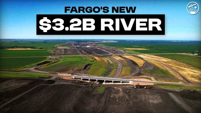
America is building a brand-new river around Fargo. The Fargo–Moorhead Flood Diversion is a roughly $3.2 billion flood-control megaproject designed to protect one of the most flood-prone metro areas in the country. Fargo and Moorhead sit in the flat Red River Valley, where the Red River flows north, spring melt can move into colder downstream areas, and floodwater spreads across an ancient lakebed with very little natural slope. Instead of simply building taller walls through town, engineers are creating a controlled escape route for floodwater: a 30-mile diversion channel, southern embankment, gated control structures, aqueducts, bridges, levees, and major transportation crossings. The project is fascinating because it is not just holding water back. It is deciding how much water the city can safely handle, then giving the rest of the flood somewhere else to go.
Fair-use disclaimer: This video may use third-party images, maps, clips, and public records for commentary, education, criticism, and news reporting.
Fair-use disclaimer: This video may use third-party images, maps, clips, and public records for commentary, education, criticism, and news reporting.
0
0
12