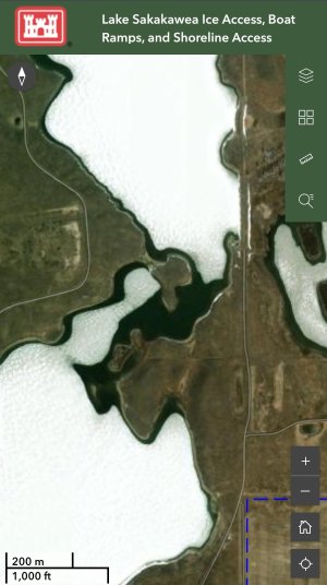

Something I found interesting is looking at the open water spots visible in the satellite image the Corps used for the Sakakawea boat ramp status map. The image was taken as the lake was starting to give up her ice, and the perennial bad spots I'm aware of are open water in the photo. For example, this area of Nelson Bay which often has a spot of open water through the dead of winter is wide open in this image.
This image also shows why it's important to avoid driving over shallow humps in the middle of the lake as those spots give up their ice faster than much of the shoreline, even if they top out below the surface.
If one was new to the lake and worried about "springs" or bad spots, I would suggest avoiding any areas that are open water in the imagery at the link below.
Keep it topside.
https://experience.arcgis.com/experience/e7b8ba79472b485a8c4d291579a4edbe/page/Main-Page
Attachments