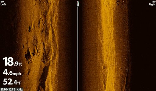
I have been using Humminbird Side Imaging since 2009. Yesterday I took my first spin with my Helix 10 G2N and MEGA. Yeah, I would say its pretty good. I still have a couple tweaks on the transducers but so far petty good.
Great improvement , I bought a 1198 when released , it's to point that as soon as you plug a new eletronic anything in its outdated.I don't understand ,other then the cost of doing business why boat eletronics have not come down in price?
I would say they have come down in price, way down. Think about it in 2009 a 997 was $1,500 now 9 years later the Helix 10 is $1700 with HD, with MEGA and AutoChart Live. A lot more for the money.
But look at it this way. You can buy that same tech in Helix 5 for $600
The thing is to keep the prices the same they keep adding tech. If it was still the same old screens and tech it would be way cheaper.
How often do you updadate? Look at used prices when updadated to a new unit? What does it cost a year?
I don't buy a new boat every year , but I try to stay close to the best eletronics. Madness!
How often do you updadate? Look at used prices when updadated to a new unit? What does it cost a year?
I don't buy a new boat every year , but I try to stay close to the best eletronics. Madness!
I have been on the three year plan. I ran my 997 for 5 years then when I got my current boat in 2014 I started new. The idea of MEGA and the new mapping is what got me to go change again this year.
I don't have the mega yet. I added a Helix 7 and 9 to the mix this year. Next year I'll hopefully update the 1199 to a Helix 10 or 12 mega si combo, and probably bump my 899 up to a Helix 9....unless I update boats.
With most gps units accuracy 3 meter or better i feel it is hard to get a lake contour map with better line clarity. Once GPS becomes accurate to 3 feet or less how can these maps be viable alternative to real time position. To have that kind of accuracy you would need your own GPS base that is calibrated to real time satellite position.
I would like to see an advancement in real time hd 360 3d imaging which would be done by three ducers working together to build this map. Since working with survey equipment unless you have a base station to relay real time satellite signal position these maps will be differnt from the next time who pass over the same exact area.
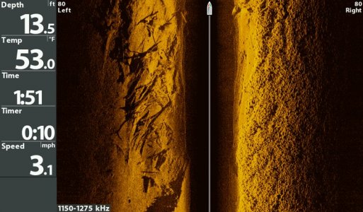
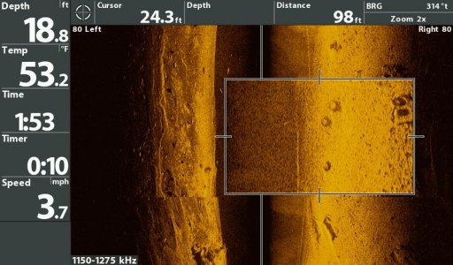
I don't know how to read these, to the untrained eye it looks like an xray.
A few of my friends have them, and seem to like it. I am just too damn cheap to put a few G into something I use so little anymore.
I have my trusted spots and fish like my fathers before me, and that is why I likely catch less, but still seem to have a freezer full of fish.
I have heard before that the hummingbird side scan is better than lowrance and the down scan is better on a Lowrance. Might be true. I know my down scan on the HDSunits was really good last year. Could pick out fish around breaking structure, weeds, trees etc that were just blobs on 2D